WildSeek has established and is supporting a network of Community Hubs for the conservation and rescue response of native species across Australia. It brings together leading environmental organisations and university researchers to create an innovative drone solution for surveying koala (Phascolarctos cinereus) populations.
Together local partners, staff and volunteers are using the data captured at the Hubs and analysed by the Queensland University of Technology to make informed decisions regarding advocacy, protection, and management of koalas, other wildlife, and their habitat.
What does WildSeek do?
WildSeek supports the development of skills particularly with using drones and other technology to generate accurate data that will help communities make informed decisions about planning for how they can protect native habitat in their region.
One outcome of the Black Summer bushfires was how little we knew about the koala populations and other threatened species, WildSeek seeks to improve our capacity to understand the populations and use that information to make informed decisions about how we can protect them.
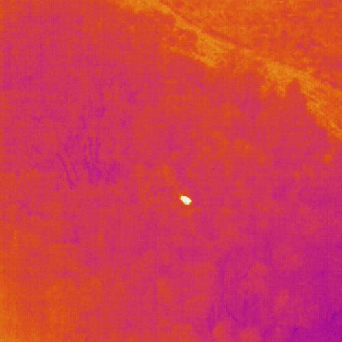
Thermal image of a koala image supplied Noosa & District Landcare
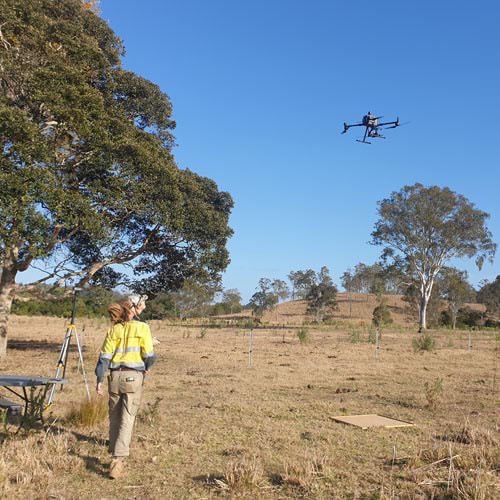
Drone flight in Mimburi, image supplied by Noosa & District Landcare
WildSeek near you
WildSeek is being delivered by Community Hubs located in New England Region of NSW (Tamworth Regional Landcare Association); MidCoast NSW (Mid Coast 2 Tops Landcare); South East Queensland (Noosa & District Landcare Group Inc.); East Gippsland in Victoria (East Gippsland Conservation Management Network); and the Sydney Region in NSW (Landcare Australia).
Support WildSeek
Coordinated by Landcare Australia, each Hub is equipped with innovative technology, capacity, support systems and training to generate and share accurate data on wildlife populations and individual animals. This enables more effective response in emergency situations by significantly improving knowledge of wildlife density and distribution across each region. To help us support the important work of the Community Hubs, we are actively seeking financial contributions from partners and donors.