Innovative online land use map to support Tropical Cyclone Debbie recovery
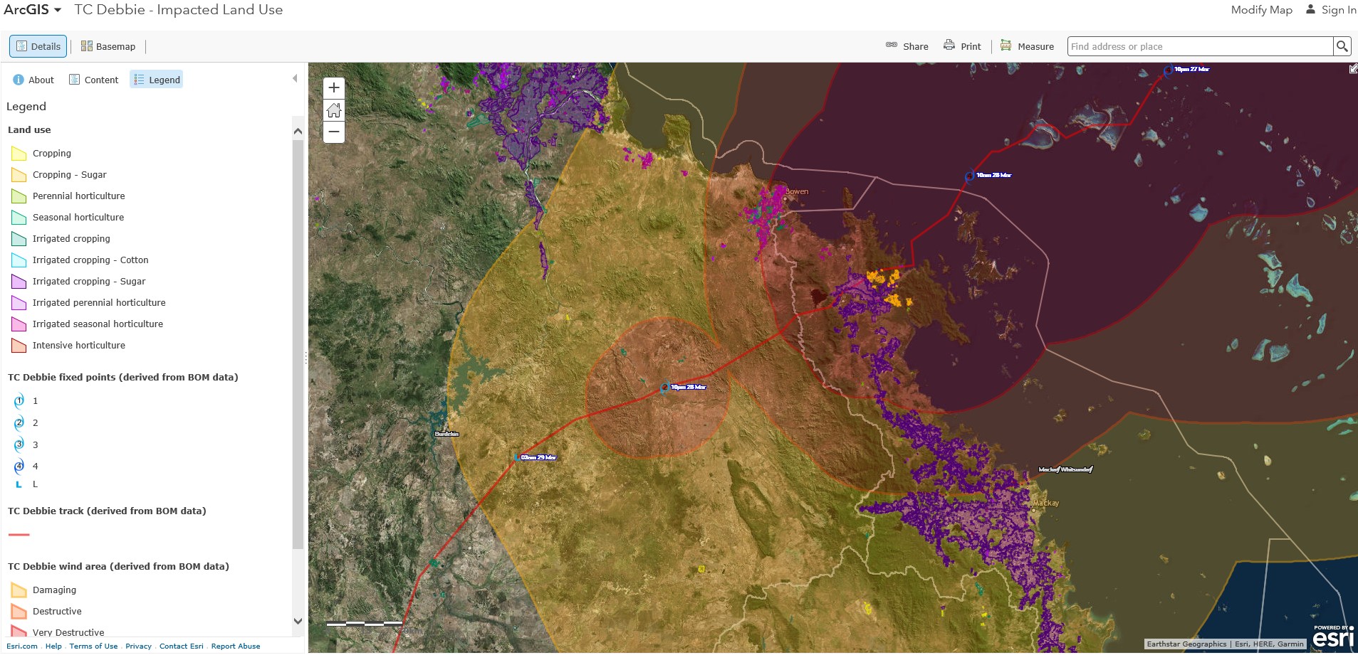
Queensland Government scientists have developed an online map to assist the recovery of agricultural lands hit by Tropical Cyclone Debbie. The map shows the land uses that are affected by the destructive wind zones and subsequent weather event. It was produced using satellite and aerial imagery, informed by on-ground data collected with a purpose-built app.
Interested members of the public can find the web maps by searching the ArcGIS website for ‘TC Debbie – Impacted Land use’ and ‘Horticulture Tree Crops – Cyclone Debbie’. The companion app, Land Use Survey by QLUMP, allows citizen scientists to upload photos and observations to improve maps. The app can be downloaded for iOS from the Apple App Store or for Android from the Google Play Store.
The Department of Science, Information Technology and Innovation developed the map and app as part of the Queensland Land Use Mapping Program (QLUMP). App development has been funded through a national tree crop project supported by Horticulture Innovation Australia and the Australian Government Department of Agriculture and Water Resources’ Rural R&D for Profit programme.
QLUMP is the Queensland contribution to the Australian Collaborative Land Use and Management Program, a consortium of Australian, state and territory government partners developing nationally consistent mapping. Funding is provided by participating agencies and the National Landcare Program. Current work includes mapping in Queensland (Mackay Whitsunday), the Northern Territory, Tasmania, the Goulburn Murray Irrigation District and Victorian Pest Free Area, and South Australia’s Greater Adelaide region). The data will be published in the Catchment scale land use mapping update for 2017 later this year. Mapping of banana plantations, along with other horticulture, was recently completed for Northern Queensland, New South Wales and Western Australia.
Land use maps can provide critical information for planning, responding to and recovering from the impact of natural disasters such as cyclones, floods, bushfires and droughts. The maps are also essential sources of information to support agriculture, natural resources and biosecurity risk management.
For more information visit http://www.agriculture.gov.au/abares/aclump/land-use/land-use-mapping.
