The Atlas of Living Australia supporting the work of Landcarers
By Peter Brenton, Atlas of Living Australia
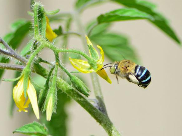
A sighting of the blue-banded bee uploaded to the ALA by Anthony Katon in NSW.
The Atlas of Living Australia (ALA) is the national biodiversity data facility. It brings together biodiversity data from thousands of sources and makes it accessible to researchers, policy makers, natural resource managers, industry, educators and the general public. The ALA is funded by the Australian government through the National Collaborative Research Infrastructure Strategy (NCRIS) and hosted by the CSIRO.
Data in the ALA is provided by all the major flora and fauna collections in museums, herbaria and research organisations; state and territory flora and fauna databases; major interest group databases; and a myriad of other sources from researcher-driven and community-based citizen science projects to natural resource managers (including Landcarers), individual researchers, industry-based ecologists and local government organisations.
The ALA infrastructure also comprises software tools, databases and servers which make it possible to collect, process, store, discover, visualise, analyse and access the content.
Many different tools have been developed to provide these functions. Some of the tools likely to be of particular interest to Landcarers and the NRM sector include the following:
The main ALA
A suite of integrated applications to search, filter, view and access a vast array of publicly available biodiversity information and occurrence data for over 140,000 species of plants, animals, fungi and micro-organisms.
Spatial Portal
A sophisticated spatial analysis tool allowing you to look at your data in combination with other data and almost 500 spatial layers. Use it to work out what is likely to happen to certain species under projected climate change scenarios; find where seedstock for certain species which are tolerant to certain environmental conditions might be found; and many other uses too.
BioCollect
ALA’s field data collection tool for all kinds of data collection including citizen science and non-citizen science assessment and monitoring surveys, as well as activity-based project management for your weed and pest management projects, and restoration and rehabilitation projects. Easily create and manage your own data collection projects.
Sandbox
A simple tool for loading and visualising your own data using ALA tools and data.
DigiVol
A crowd-sourced digitisation platform. This is a great tool to turn your field notes, data sheets and camera trap images into digital information so it can be analysed and used.
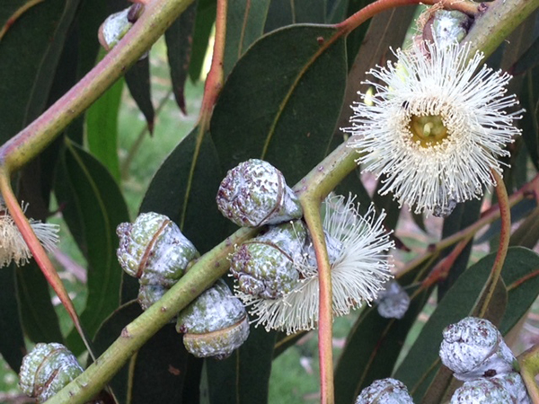
An image of Eucalyptus globulus (blue gum) uploaded to the ALA by Tony Ladson in Victoria.
All ALA data and tools are accessible online.
The ALA team works hard to improve the platform and we encourage constructive feedback from users and contributors to help make it better. We encourage everyone with an interest in biodiversity to contribute data – both big and small – to improve scientific research in biodiversity and outcomes from biodiversity policies and management.
Go to ala.org.au to register and start exploring Australia’s biodiversity.
